Back Гісарскі хрыбет Byelorussian Хисарски хребет Bulgarian Hissarský hřbet Czech Hissargebirge German Cordillera Gissar Spanish Hisori ahelik Estonian رشتهکوه حصار Persian Hisorvuoret Finnish Monts Hissar French गिस्सार पर्वत Hindi
| Hisar Range tg. Қаторкӯҳи Ҳисор uz. Hisor tizmasi ru. Гиссарский хребет | |
|---|---|
 View of the Anzob Pass across the Hisar Range with the Zarafshan Range in the background | |
| Highest point | |
| Peak | Alpomish Peak |
| Elevation | 4,668 m (15,315 ft) |
| Coordinates | 38°55′N 68°15′E / 38.917°N 68.250°E |
| Geography | |
| Country | Tajikistan, Uzbekistan |
| Parent range | Pamir Mountains |
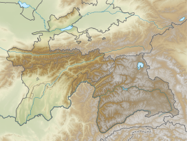
Hisar Range (Tajik: Қаторкӯҳи Ҳисор; Uzbek: Hisor tizmasi, Russian: Гиссарский хребет; Ukrainian: Ґаторкугі Гісор; Persian: رشتهکوه حصار; also known as Hissar, Hisor, or Gissar Range) is a mountain range in Central Asia, in the western part of the Pamir-Alay system, stretching over 200 km in the general east–west direction across the territory of Tajikistan and Uzbekistan.
